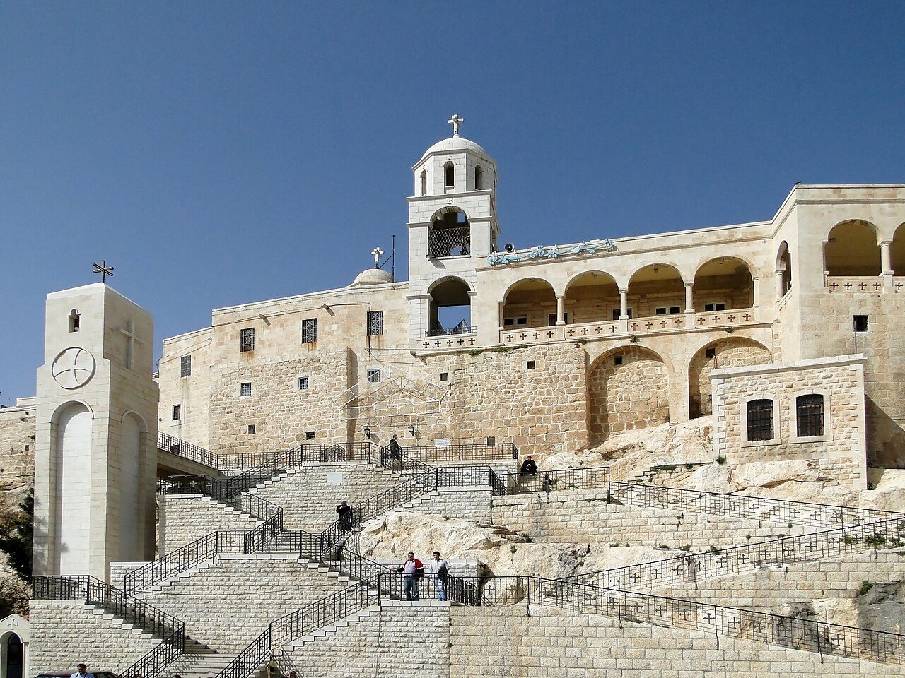
Volume XIII · 31 chapters
Rif Dimashq
A complete 32-chapter reference volume on Rif Dimashq: location, identity and administrative evolution around the capital; the Eastern Ghouta and its towns — Douma, Harasta, Arbin, Saqba, Zamalka, Ain Terma, Kafr Batna, Hamouriyah, Jisreen and Nashabiyah; the Marj plain, Al-Tall, Qatana, Al-Kiswah, Darayya, Muadamiyat al-Sham, Sahnaya and Saasaa; Mount Hermon, Zabadani and Wadi Barada; the Barada river and the Ghouta through history; castles, forts and defensive sites; monasteries, churches and shrines; archaeological sites; traditional crafts, rural cuisine, dress and social customs; notable figures; and a practical guide to tourism in the governorate.
Chapter 01
Chapter One — Damascus Countryside Governorate
Part One — Location, Identity, and Historical and Administrative Development
1.1Introduction
Rif Dimashq Governorate forms the geographical framework that surrounds the Syrian capital from almost all sides. It is one of the country's most diverse governorates in terms of nature, history, society, and architecture. Across a vast area extending from the foothills of Mount Hermon (Jabal al-Sheikh) in the south to the Qalamoun Mountains in the north, and from the fertile Ghouta in the east to the Barada Valley and Al-Zabadani in the west, cities, towns, villages, valleys, mountains, and plains coexist in a single geographical tableau, making Rif Dimashq the natural extension of the capital for thousands of years.
The Damascus countryside was not merely an area surrounding the city of Damascus; it was always an integral part of its economic, social, and cultural life. From it came water, vegetables, fruits, grains, timber, and stone, and through its roads passed trade caravans, pilgrims, armies, and travelers coming from the Arabian Peninsula, Iraq, Anatolia, and the Mediterranean coast. Its towns also formed independent religious, scientific, and commercial centers, many of which retained their distinct identity despite their gradual integration into the capital's urban sphere.
The governorate is also distinguished by containing some of the oldest continuously inhabited human settlements in the Levant, having been settled by prehistoric civilizations, then the Arameans, followed by the Persians, Greeks, Romans, Byzantines, Muslim Arabs, Ayyubids, Mamluks, and Ottomans, up to the modern era. They left behind architectural, cultural, and religious traces that reflect this unique civilizational accumulation.
1.2The Geographical Location
Rif Dimashq Governorate is located in the southwest of the Syrian Arab Republic, surrounding the city of Damascus from almost all sides, making the capital appear like an urban island situated in the heart of the governorate. This location grants it exceptional importance, as it controls most of the land routes leading to Damascus, and also serves as a link between central Syria and its south, west, and north.
The governorate borders several Syrian governorates: Homs to the north, Hama to a limited extent through some extensions, Sweida and Daraa to the south, and Quneitra to the southwest. Its western borders extend along the Anti-Lebanon mountain range, and it reaches eastward into the Syrian Badia regions. This diverse border configuration gives the governorate a varied geographical character, combining mountains, plains, plateaus, valleys, and deserts.
1.3Area
Rif Dimashq is considered the largest Syrian governorate by area, exceeding eighteen thousand square kilometers, which makes it much larger than the actual urban area of the capital, Damascus. This area includes vast mountainous regions, agricultural plains, valleys, desert lands, in addition to dozens of cities, towns, and villages that vary in size, population density, and the nature of their economic activity.
Population density is not evenly distributed; while Ghouta and the capital's belts experience high density, it gradually decreases as one moves towards the desert (Badia) or mountainous regions, where geographical nature imposes different conditions for human settlement.
1.4Relationship with the City of Damascus
It is difficult to study Damascus in isolation from its countryside, just as it is difficult to understand the Damascus countryside without studying the capital. An organic relationship developed between the two parties since ancient times, with the city relying on the countryside for food, water, and raw materials, while the countryside relied on the city as a center for administration, trade, education, justice, industries, and services.
Damascus markets daily received products from Ghouta, Qalamoun, Zabadani, Wadi Barada, Kisweh, Darayya, and other regions, while rural residents would visit the capital to sell their produce, buy their necessities, or pursue their administrative, educational, and medical affairs.
With the expansion of Damascus during the 20th century, vast parts of the countryside merged into the urban sprawl of the capital. As a result, some old towns today are connected to the city without a clear urban break, often retaining their local memory and historical identity.
1.5Natural Identity
The Rif Dimashq Governorate boasts a rare natural diversity within Syria. To the west, mountains rise, receiving greater amounts of rain and snow, while in the center, plains and orchards associated with the Ghouta spread. Eastward, the land gradually transitions into drier areas towards the desert (Badia).
This diversity led to the emergence of different patterns of settlement, architecture, agriculture, and economy. Mountain villages differed from those in the Ghouta, just as the stone towns of Qalamoun differed from the villages of Wadi Barada or the towns of the southern plains.
1.6Natural Regions
The governorate can be divided into several main geographical regions, each with an independent character. The western region includes Wadi Barada, Al-Zabadani, Bloudan, Sarghaya, and Madaya, where springs, valleys, and highlands abound. The northern region includes Al-Qalamoun with its major cities such as An-Nabek, Yabroud, Maaloula, Saidnaya, Deir Atiyah, Qara, and others, and is characterized by its relatively dry mountainous nature and its unique religious and urban heritage.
To the south and southwest extend the regions of Qatana, Artouz, Darayya, Muaddamiyat al-Sham, Al-Kiswah, and Khan al-Shih, while the Eastern and Western Ghouta form the historical agricultural region surrounding the capital, including cities such as Douma, Harasta, Arbin, Saqba, Zamalka, Ain Tarma, Kafr Batna, and others. The east gradually transitions towards the Syrian Desert through the regions of Jayroud, Al-Nasiriyah, and their surroundings.
1.7Administrative Development
The governorate underwent several administrative reorganizations since the Ottoman era, when towns belonged to various districts (aqdiyah) and sub-districts (nawahi) affiliated with the Wilayah of Damascus. After the establishment of the modern Syrian state, administrative units were reorganized numerous times until the current structure of the governorate was settled, which today includes a large number of regions, sub-districts, cities, towns, and villages.
This administrative organization reflects the governorate's vastness and diversity, as it includes areas that differ significantly in terms of population, economy, and nature, making its administration more complex compared to governorates that are smaller in area or less diverse.
1.8Population
Rif Dimashq is characterized by significant social and cultural diversity, as it includes residents who have settled in its towns for many centuries, alongside waves of internal migration that accompanied the expansion of the capital, leading to a noticeable increase in population density in the areas surrounding Damascus during recent decades.
Lifestyles vary between the mountainous towns of Qalamoun, the agricultural villages of Ghouta, and the suburbs connected to the capital. This diversity is reflected in the local architecture, dialects, social customs, building methods, and economic activities.
1.9Rural Damascus Through the Ages
The governorate has witnessed human settlement since prehistoric times, then became part of the Aramaic kingdoms that flourished around Damascus. During the Greek and Roman eras, roads, cities, and villages developed, while the Byzantine era saw the construction of a large number of churches and monasteries.
With the Islamic conquest, the region became part of the capital of the Umayyad state. Its role then grew during the Ayyubid, Mamluk, and Ottoman eras as an agricultural and commercial belt protecting the capital and securing its needs. Its importance continued after independence with the expansion of Damascus and the transformation of large parts of the countryside into connected suburbs and cities.
Part Two — Civilizational, Strategic, Economic, and Cultural Importance
1.11Rural Damascus as a Cradle of Human Settlement
Rif Dimashq is considered one of the oldest regions where human settlement was known in southern Bilad al-Sham. The abundance of water in valleys and springs, fertile soil, and temperate climate in large parts of it contributed to the establishment of human communities since prehistoric times. Archaeological discoveries scattered in Al-Qalamoun, Wadi Barada, Al-Ghouta, and the eastern slopes of the Anti-Lebanon mountain range indicate early agricultural and pastoral activity that preceded the emergence of many historical cities in the region.
With the development of agriculture and animal domestication, stable villages emerged that relied on cultivating fertile lands and natural water sources. Some of these settlements gradually transformed into towns and cities that played important economic and religious roles, while others retained their rural character until modern times. Therefore, the Damascus countryside cannot be viewed merely as modern suburbs of the capital, but rather as a region with an independent history spanning thousands of years.
1.12Rural Damascus and Trade Routes
The Damascus countryside occupied a strategic location on the historical road networks that connected Damascus to the ancient world. Roads from Palmyra, the Euphrates, and Iraq passed through it to the east; from Homs, Aleppo, and Anatolia to the north; from the Lebanese coast and the Mediterranean to the west; and from Palestine and the Hejaz to the south. This location made the province's towns stops for rest, trade, changing pack animals, storing goods, and securing travelers' needs.
With the development of transportation methods, the importance of these roads persisted, as old routes transformed into modern roads connecting the capital with Syrian governorates and neighboring countries. Many cities and towns continued to grow along these historical axes, which explains their enduring economic importance to this day.
1.13Defensive Dimension
The Damascus countryside was not merely an agricultural area; throughout history, it served as the first line of defense for the capital. The natural fortresses formed by mountains, narrow valleys, and mountain passes were all strategic elements controlling the movement of armies approaching Damascus. For this reason, the governorate witnessed numerous military campaigns and battles throughout various eras, starting from the Aramean and Assyrian conflicts, through the Roman and Byzantine periods, then the Crusader and Mongol campaigns, up to modern times.
The mountainous nature of Qalamoun, the Barada Valley, and the western passes also helped in monitoring roads and securing the capital, while the Ghouta formed an agricultural and demographic barrier, providing essential food resources during times of siege.
1.14Rural Damascus and the Economy
The economy of rural Damascus was historically linked to the diversity of its natural environment. In Ghouta, orchards and the cultivation of fruit trees and vegetables flourished, while the Qalamoun regions were known for livestock farming, some rain-fed agriculture, and stone industries. As for Al-Zabadani, Bloudan, and Wadi Barada, they relied on springs, summer tourism, and mountain agriculture.
Furthermore, various local industries developed in many towns, including stone quarrying, building material manufacturing, some food industries, and traditional crafts, in addition to trade linked to their proximity to the capital. The expansion of Damascus during the 20th century led to a significant portion of industrial and service activities relocating to the outskirts of the governorate, which altered the economic nature of several areas.
1.15Architectural Diversity
Rif Dimashq is characterized by a clear diversity in architectural styles, as the stone houses in Qalamoun differ from the old mud houses in some Ghouta villages, just as the modern villas in the western suburbs differ from the traditional rural houses in Zabadani, Maaloula, or Deir Atiyah.
This diversity is linked to numerous factors, including the nature of local building materials, climate, economic resources, social customs, and the influence of different historical periods. Therefore, the Damascus countryside offers a rich laboratory for studying the evolution of Syrian rural architecture over thousands of years.
1.16Religious and Cultural Diversity
Throughout its history, the governorate embraced a wide religious and cultural diversity, as multiple communities lived there and contributed to shaping its civilizational identity. Historic monasteries, ancient churches, mosques, shrines, and religious sites dating back to different periods are spread across the governorate, reflecting the region's status as a crossroads of civilizations and cultures.
Some towns also preserved distinctive linguistic and cultural specificities, the most famous of which is Maaloula, whose name is associated with the continued use of Western Aramaic in daily life by a portion of its inhabitants, which gives it exceptional cultural value worldwide.
1.17Social Diversity
The Damascus countryside comprises communities with diverse lifestyles, encompassing agriculture, pastoralism, trade, industry, and services. The proximity of the capital led to a clear intermingling of the countryside and the city, resulting in modern suburbs that combine urban characteristics with some rural features, while other villages maintained their traditional social structure and extended family ties.
These differences are reflected in the forms of dwellings, market patterns, daily customs, local dialects, and even in the planning of villages and towns, which gives each region a distinct character worthy of independent study.
1.18Natural Resources
The governorate possesses diverse natural wealth, including mountains, valleys, caves, rock formations, and plains, in addition to limited forests in some highlands and mountainous areas. This diversity has contributed to the emergence of different plant and animal life environments, and has also provided raw materials used in construction and traditional industries.
The limestone rocks prevalent in Qalamoun and the mountains of Rural Damascus are among the most important materials that influenced local architecture, as mountainous villages relied on them for building homes, walls, churches, and monasteries over many centuries.
1.19Rural Damascus and Tourism
The governorate boasts significant tourism potential that is difficult to categorize into a single type, as it combines historical, religious, natural, and cultural tourism. Visitors can move in a short time from the historical alleys of Maaloula to the mountain resorts of Bloudan and Al-Zabadani, or from the ancient monasteries of Saidnaya to the agricultural villages of the Ghouta, and then to the archaeological sites scattered throughout Al-Qalamoun.
These sites are distinguished by their great diversity, making Rural Damascus one of the richest Syrian regions in terms of the variety of tourist experiences, not just the number of sites.
Part Three — Natural and Human Divisions, and Urban Identity
1.21Major Geographical Regions
The Rif Dimashq Governorate can be divided into a number of natural regions, each possessing an independent geographical and historical character. To the west, the Al-Zabadani and Wadi Barada region extends alongside the Eastern Lebanon Mountain Range, where mountains, valleys, springs, and mountain towns historically associated with summer resorts and routes leading to the Beqaa Valley intertwine. To the north extends the Al-Qalamoun region, one of the largest natural regions in Syria, which includes cities and towns that played important commercial, religious, and military roles throughout history, and is characterized by its limestone mountains, wide valleys, and natural caves.
Around the capital, the Eastern and Western Ghoutas spread, which for many centuries formed Damascus's green belt. To the south and southwest extend the plains and highlands of Qatana, Al-Kiswah, Khan Al-Shih, Darayya, and Al-Maadamiya. Then, the lands gradually transform eastward towards the semi-desert regions and the Badia in Jayroud, An-Nasiriyah, and their surroundings. This great diversity led to clear differences in settlement patterns, economy, architecture, and local customs from one region to another.
1.22Villages and cities
The governorate includes dozens of cities and hundreds of towns and villages, some dating back thousands of years, and others emerging from modern urban expansion during the 20th century. Significant differences can be observed between cities directly connected to Damascus, such as Darayya, Harasta, and Qudsaya, and mountainous cities like Yabroud, An-Nabek, Saidnaya, and Maaloula, or western resorts like Zabadani and Bloudan.
Most of these cities retain a distinct individuality, whether in their urban planning, dialect, architecture, or economic activity, which justifies dedicating a separate chapter to each city within this volume instead of merely presenting them in a single chapter.
1.23Mountains
Mountains constitute the most prominent natural feature in large parts of the Damascus countryside. To the west, the Anti-Lebanon mountain range rises, while Qalamoun dominates the northern part of the governorate. These mountains have influenced the climate, water abundance, population distribution, and transportation routes, and have also provided the stone used to build villages, churches, monasteries, and castles over many centuries.
The mountains were not only an obstacle to urban development but also a source of natural resources, a passage for caravans, and a site for fortresses and monasteries. They also provided a suitable environment for grazing and mountain agriculture, contributing to the emergence of towns that have preserved their unique character to this day.
1.24Plains
Plains are widespread in Ghouta and the southern and eastern parts of the governorate, and throughout history, they have been the most suitable areas for settlement and agriculture. The flat terrain and fertile soil facilitated the establishment of relatively close-knit villages that maintained strong economic and social ties with the city of Damascus.
These plains also played an important role in the movement of armies and caravans, as major roads connecting the capital to various parts of Bilad al-Sham passed through them.
1.25Valleys
Numerous valleys cut through the governorate, forming natural passages between the mountains and contributing to the establishment of settlements around them. Wadi Barada is the most famous of these valleys, but it is not the only one; Qalamoun also contains several valleys that have influenced the distribution of villages, agricultural routes, and water sources.
These valleys facilitated the emergence of agricultural terraces and small fields, and also became natural passages for ancient and modern roads.
1.26Climate
The climate within the governorate varies significantly depending on elevation and topography. In mountainous regions, winters are colder with snowfall in many years, while the Ghouta is characterized by greater moderation and temperatures that allow for the cultivation of diverse types of trees and crops.
As for the eastern regions, continentality and aridity gradually increase as one approaches the desert (Badia), which was reflected in the vegetation cover, population density, and building patterns.
1.27Botanical Diversity
The variation in climate and soil produced a remarkable diversity in vegetation, ranging from fruit trees in the Ghouta and Barada Valley, to mountain plants in Qalamoun, and then desert plants in the east. This diversity was linked to the daily lives of the inhabitants, whether in food, construction, folk medicine, or traditional industries.
Trees also contributed to shaping the natural landscape of many towns, becoming part of their visual identity across generations.
1.28Wildlife
The governorate is home to various types of birds, mammals, and reptiles that have adapted to mountainous, agricultural, and semi-desert environments. Despite changes in the natural environment due to urban expansion, some areas still retain a biodiversity worthy of study and protection.
Interest in wildlife is not limited to its environmental value, but also because it is part of the historical relationship between humans and nature in rural Damascus.
1.29Rural Architecture
Rural architecture in the governorate varies according to the local environment. In Al-Qalamoun, limestone was used extensively, while Ghouta villages relied on stone, mud, and adobe according to available resources. In areas close to Damascus, modern buildings influenced by urban architecture appeared during the 20th century, while retaining some rural elements.
The forms of houses also evolved in response to changing needs of the inhabitants, transitioning from simple courtyard homes to multi-story buildings, especially in cities that gradually merged with the capital.
1.30Settlement Patterns
Three main patterns of human settlement can be observed within the governorate. The first consists of cities connected to the capital, which have become part of its urban fabric. The second includes independent historical cities that have retained their ancient centers despite modern expansion. The third encompasses mountainous and agricultural villages that still preserve varying degrees of their traditional character.
This diversity reveals significant differences in lifestyles, economic structure, services, and social relations, which will become clear when studying each city or town in the upcoming chapters.
1.31Relationship between Countryside and City
The relationship between Damascus and its countryside underwent a significant change during the 20th century. While the countryside previously relied heavily on agriculture and supplying the capital with food products, many of its inhabitants now work in institutions, industry, and services within Damascus, while investments and educational, health, and residential centers have moved to the outskirts of the governorate.
This intermingling led to the emergence of areas where it is difficult to define the dividing lines between city and countryside. However, many towns still retain their local memory, dialect, and specific customs despite this urban integration.
1.32Urban Expansion
In recent decades, the Damascus countryside has experienced extensive urban expansion due to population growth and the capital's sprawl. Large areas of agricultural land near Damascus have been converted into residential, industrial, or service zones, while mountainous regions have been less affected by this expansion due to their topographical nature.
This transformation led to a significant change in the form of many towns, as parts of the traditional urban fabric disappeared, replaced by modern buildings, while historical centers persisted in a number of cities.
Part Four — Historical Significance in Syria and the Levant
1.34Rural Damascus Through Civilizations
Rural Damascus represents one of the most continuous regions of Bilad al-Sham (the Levant) in terms of human settlement. It was not merely a geographical area surrounding the capital, but rather a continuous stage for the succession of civilizations from prehistoric times to the modern era. Each historical period left its traces in villages, roads, temples, monasteries, fortresses, and building styles, making the governorate an open record of human development in southern Syria.
Over thousands of years, ancient settlements did not completely disappear; rather, they gradually evolved, with cities built upon cities, and almost the same roads reused. Some springs and mountain passes continued to serve the same functions they had since ancient times, which gives the Damascus countryside exceptional archaeological and historical value.
1.35Aramaic Period
During the first millennium BC, the region witnessed the flourishing of Aramaic kingdoms that made Damascus an important political center, while its countryside formed the agricultural, defensive, and economic sphere surrounding the capital. It is believed that many of the current villages trace their roots back to that period, even if their names changed or they expanded over time.
The Arameans contributed to the development of settlement networks, local roads, and the exploitation of agricultural lands. They also left a linguistic and cultural impact that lasted for many centuries, some traces of which are still present in place names and local dialects.
1.36Greek and Roman Periods
With the region's inclusion in the Seleucid state and then the Roman Empire, the Damascus countryside witnessed better organization of roads and administrative infrastructure, and cities and villages were connected by more regular transport and trade networks. Public facilities, bridges, and temples were also built, and some Roman roads remained in use during subsequent eras.
Trade flourished between Damascus and neighboring cities, leading to the growth of a number of towns located on main roads, and some small stations transformed into important local centers.
1.37Byzantine Period
During the Byzantine era, the governorate witnessed extensive religious activity, especially in the mountainous regions, where monasteries, churches, and monastic centers were established, many of which still stand today. Saidnaya, Maaloula, and other areas became renowned religious centers, attracting visitors and pilgrims from various regions.
Religious architecture also developed during this period, with elaborate stone buildings emerging that still form part of the governorate's architectural heritage.
1.38Islamic Period
After the Islamic Conquest, Damascus became the capital of the Umayyad State, and its countryside gained double importance as a source of food and raw materials, in addition to being the first line of defense for the capital and a main passage for caravans and armies.
During the Umayyad, then Abbasid, Ayyubid, and Mamluk eras, attention to roads, caravanserais, bridges, and urban centers increased, and existing villages expanded, with new religious and educational establishments appearing in a number of areas.
1.39Ottoman Period
During the Ottoman era, the Damascus countryside experienced relative stability in many of its regions. Trade associated with the Syrian Hajj route flourished, and some towns located on main roads developed as a result of the passage of trade caravans and pilgrims.
During this period, a number of khans and public facilities were restored, and agricultural activity increased in the Ghouta and the areas surrounding Damascus, while the towns of Qalamoun maintained their commercial and religious roles.
1.40The Nineteenth Century and the Beginnings of Modernization
With the development of transportation and increased contact with Europe during the 19th century, some towns in the Damascus countryside began to witness gradual urban and administrative changes. Roads also improved, commercial activity increased, and new services emerged, linked to the movement of travelers between Damascus, Lebanon, and northern Syria.
At the end of the 19th century and the beginning of the 20th century, the construction of the Hejaz Railway contributed to enhancing the importance of several areas within the governorate located along the railway line.
1.41The Modern Syrian State Period
After the establishment of the modern Syrian state, the governorate witnessed significant administrative and urban expansion. Many villages transformed into cities due to population growth and improved services, and schools, hospitals, and government institutions were established in various areas.
With the expansion of the capital after independence, the suburbs close to Damascus became more integrated into the economic and administrative life of the capital, while relatively distant cities maintained their local character.
1.42Urban Transformations in the 20th Century
The second half of the 20th century witnessed rapid urban expansion, which led to a change in the appearance of many towns. New neighborhoods, modern streets, and industrial and commercial areas emerged, and some old villages became part of the large urban agglomeration surrounding Damascus.
Despite these transformations, the historical centers of several cities still retain their old alleys, traditional buildings, and markets, which gives them significant heritage value.
1.43Rural Damascus Today
Today, the governorate represents one of Syria's most diverse regions in terms of population, nature, and economy. It includes urban suburbs connected to the capital, historical cities, mountain towns, agricultural areas, and religious and archaeological sites, in addition to a wide network of roads connecting various parts of the country.
This diversity makes the Damascus countryside a region difficult to condense into a single image, as the natural, urban, and cultural landscapes differ significantly between Al-Zabadani, Maaloula, Douma, Qatana, Deir Atiyah, or Wadi Barada, while all retain their belonging to the same historical region.
1.44The Governorate's Importance in Syrian Heritage
Rural Damascus holds a special place in Syrian heritage, not only due to its proximity to the capital but also because it encompasses, within a single area, most of the elements that form the identity of the Levant: from mountains, plains, and valleys, to monasteries and mosques, markets and ancient villages, stone architecture, local dialects, traditional crafts, rural cuisine, and social customs.
Therefore, studying the governorate provides an entry point for understanding the history of Damascus itself, and also represents a miniature model of the geographical and cultural diversity that characterizes Syria.
Part Five — Civilizational Characteristics, Regional Identity, and Reading Methodology
1.46Rural Damascus as a Civilizational Region
The importance of Rural Damascus is not limited to being an administrative governorate surrounding the capital; rather, it represents an integrated cultural region within which diverse communities have developed, preserving their unique identities despite their continuous connection to the city of Damascus. Every city and town in this region possesses an independent history that often predates the emergence of modern administrative boundaries. Moreover, each area has its own natural environment, local dialect, architecture, and methods of land utilization and social life organization.
Therefore, studying the Damascus countryside does not rely on viewing it merely as an urban extension of the capital, but rather as a network of historical centers that developed over thousands of years and then gradually became economically, administratively, and culturally linked to Damascus, while retaining a significant degree of local independence.
1.47Diversity between West and East
The diversity within the governorate is clearly evident when moving between its different regions. In the west, mountains, valleys, springs, and summer resorts dominate, with stone villages adapted to the rugged terrain. In Ghouta, plains and historic agricultural villages that relied on irrigation networks and fertile lands stand out, while the landscape gradually changes towards the east, becoming drier and more expansive as it approaches the desert.
This natural variation led to differences in building patterns, village distribution, land utilization methods, and even in the form of streets, public squares, and markets, which gives each region a distinct urban character.
1.48Qalamoun as an independent region
Al-Qalamoun represents one of the most important historical regions in Bilad al-Sham (the Levant), and it cannot be considered merely a part of Rural Damascus. Throughout history, it served as a transit area between Damascus and Homs, and an important commercial and religious center. It also hosted a large number of monasteries, churches, and stone towns that preserved their traditional architectural character.
Its cities, such as An-Nabek, Yabroud, Saidnaya, Maaloula, Deir Atiyah, and Qara, reflect a great diversity in history and urbanism, which will be detailed in the chapters dedicated to each city.
1.49Ghouta as the Natural Extension of Damascus
For many centuries, the Ghouta represented the environment upon which the capital's economic life was based. It provided food and raw materials, contributed to moderating the climate, and formed a natural barrier surrounding the city. The Ghouta was not merely an agricultural area; it encompassed large villages, local markets, mosques, schools, rural homes, and sophisticated ways of life linked to the exploitation of land and water.
With the expansion of Damascus, a large part of the traditional landscape changed. However, many cities and towns still retain their historical roots, which date back many centuries.
1.50Mountain Resorts
The regions of Al-Zabadani, Bloudan, Baqin, Sarghaya, and Madaya gained widespread fame as some of the most important summer resorts in Bilad al-Sham, benefiting from their high altitude, moderate climate, abundant springs, and proximity to Damascus. These areas attracted visitors since the late 19th century, and hotels, rest houses, and summer homes developed there during the 20th century.
The summer resorts were not just places for entertainment; they played a significant economic role in stimulating trade and services, and also influenced the development of local architecture and the emergence of new building styles.
1.51Cities Connected to the Capital
Cities such as Darayya, Harasta, Qudsaya, Al-Hameh, Al-Maadamiya, Sahnaya, and Jadidat Artouz became part of the large urban area surrounding Damascus. Despite this urban connection, each city has a history that predates the emergence of modern suburbs by many centuries, and many retain old centers, markets, mosques, churches, and historical sites that deserve independent study.
This volume will work to differentiate between the ancient history of these cities and the modern urban transformations they have undergone in recent decades.
1.52Historic agricultural cities
The major cities of Ghouta, such as Douma, Harasta, Arbin, Saqba, Zamalka, Ain Terma, and Kafr Batna, emerged as agricultural and commercial centers that relied on the fertile lands surrounding them, and where markets, crafts, and local services developed. Over time, some of these cities became large urban centers, yet their agricultural roots are still evident in their planning, names, and some aspects of their lifestyle.
Each of these cities will be discussed as an independent historical unit, with a study of its development from the earliest times to the present day.
1.53Rural Damascus in Syrian Memory
Rural Damascus features prominently in Syrian literature, travelogues, memoirs, photographs, and oral narratives. Zabadani and Bloudan have been associated with summer resorts, Maaloula with Christian heritage and the Aramaic language, Saidnaya with monasteries, Ghouta with orchards, and Qalamoun with mountains and historical routes. The names of many of these towns have become part of the collective memory of Syrians, whether through summer trips, trade, education, or religious and social occasions.
This memory is not limited to major events but includes details of daily life, such as weekly markets, traditional bakeries, stone houses, springs, local dialects, and the social relationships that characterized each region.
Cities in this governorate