Volume XII · 7 chapters
Deir ez-Zor
A complete 7-chapter reference volume on Deir ez-Zor: the geography of the middle Euphrates valley, the Shamiya and Jazira banks, river islands, climate and the badia; history from prehistory through the classical and Islamic eras to the Ottoman city, the French Mandate and modern oil-era growth; the city of Deir ez-Zor and the towns of the governorate; the archaeological sites and historic cities including Mari, Dura-Europos, Halabiya-Zalabiya and Al-Rahba; the Euphrates, the Khabur and the steppe; cultural heritage and urban life; tourism and visitor experiences; and a practical guide for visitors.
Chapter 01
Deir ez-Zor: Geography, History, and Cultural Identity
Deir ez-Zor Governorate is situated in eastern Syria along the Euphrates River, in a region whose location has, for thousands of years, served as a link between the Syrian Desert, Mesopotamia, the Syrian Jazira, and the cities of the interior. Deir ez-Zor cannot be understood as a city or governorate separate from the Euphrates, as the river is the natural element that shaped the pattern of settlement, roads, crossings, and islands, defined the relationship between the two banks, and historically connected the region to Iraq on one side and the Syrian interior on the other. The document presents the governorate as an essential part of the Middle Euphrates, extending southeastward to the Iraqi border, and includes, alongside the city of Deir ez-Zor, centers such as Al-Mayadin, Al-Bukamal, Al-Ashara, Al-Quriyah, Hajin, and Al-Busayra, while vast areas of the desert extend behind the riverine strip.
The uniqueness of Deir ez-Zor lies in the convergence of three adjacent geographical and historical worlds: the Euphrates, with its water, islands, crossings, and cities; the Khabur, serving as a corridor connecting the Euphrates to the Syrian Jazira; and the desert (Badia), encompassing ancient routes, wells, wadis, historical sites, and open spaces that for centuries facilitated movement between Syria and Iraq. Therefore, the province's history cannot be reduced solely to modern Deir ez-Zor city, as it is surrounded by some of the most important ancient Near Eastern cities such as Mari, Dura Europos, Baghouz, Terqa, Halabiye, Zalabiye, and Al-Rahba, which are the subject of Chapter Three of this volume.
1.1Geographical Location
The city of Deir ez-Zor is located on the western bank of the Euphrates River, at a point where roads converge from Raqqa and Aleppo to the west, from Al-Hasakah and the Khabur Valley to the north, from Al-Mayadin, Al-Bukamal, and Iraq to the east and south, and from Palmyra and the Syrian Desert towards the interior. This location has given the city a central role in managing and connecting a vast area of eastern Syria. The urban and natural landscape of the governorate extends along the Euphrates axis more than it spreads equally in all directions. Therefore, the main cities and towns appear as successive nodes along the river road: the city of Deir ez-Zor approximately in the center, then Al-Mayadin, Al-Ashara, Al-Quriyah, Hajin, and Al-Bukamal towards the southeast, while other areas extend north and west towards the Khabur, Raqqa, and the desert. This longitudinal structure is very important in understanding the governorate; the Euphrates acts as the backbone around which roads, cities, bridges, and historical sites are organized.
1.2Deir ez-Zor in the Middle Euphrates Valley
Deir ez-Zor can be viewed as one of the natural capitals of the Middle Euphrates Valley. The city is not merely located on a passing river; rather, it lies in a region where the Euphrates served as a route, a resource, a crossing, and a geographical boundary simultaneously. Kingdoms, cities, and fortified centers emerged along this valley from early periods. Civilizations succeeded one another here because the riverine route provided a means of communication between distant regions, while overland crossings connected it to the Khabur, the Jazira, the Badia, and Iraq. Therefore, the study of Deir ez-Zor should begin with the map, not solely with modern administrative boundaries; history moved along the river centuries before the current borders emerged.
1.3The Euphrates and the Shaping of the Geographical Landscape
The Euphrates does not represent a boundary between two regions as much as an element that unites them. It divided the area into two banks, which bridges, boats, and crossings continuously reconnected. The report indicates that the river created islands, orchards, and the Al-Huwayqa area, and its course changed over time due to siltation, erosion, and water shifts, leading to changes in some natural boundaries and access routes. The relationship between Deir ez-Zor and the Euphrates is evident in the city's very form. Early neighborhoods emerged near the bank and crossing points, then urban development gradually expanded inland with the advent of modern roads, administration, institutions, and markets. The report describes the river as an element that organized the city's growth, the direction of its streets, and its economic and social relationships, not merely a scenic view on its edge. The islands and river passages also formed distinctive spaces; the Al-Huwayqa, islands, and Suspension Bridge will be discussed in more detail in Chapter Two.
1.4Al-Shamiyah, Al-Jazira, and the Two Banks
Historically, the inhabitants of the region referred to the two banks of the Euphrates as Al-Shamiya and Al-Jazira. These are not merely geographical directions but represent two ways of understanding the area separated by the river, then reconnected by crossings and bridges. The western bank is connected to routes coming from inland Syria and the desert, while the other bank links to the Syrian Jazira region and the Khabour River. This location made Deir Ezzor a natural point of contact between two distinct geographical systems. Historically, crossings relied on boats and ferries, and later bridges became a key element in modern movement, most famously the Suspension Bridge, which transformed into a visual symbol of the city and will have a dedicated section in Chapter 2.
1.5River Islands and Islets (Huweijat)
Among the most important natural features of the Euphrates in Deir ez-Zor are the islands and 'huwayqat' (small islands/shoals) that appear within the channel or near the banks. This land is not entirely stable; the river deposits silt in one place and erodes the bank in another, and small channels and water paths can change over time. Al-Huwayqa, in particular, has been closely associated with the city of Deir ez-Zor, becoming part of its urban landscape and memory, while other islands have played diverse roles in movement, fishing, and recreation.
1.6Climate and Surrounding Environment
Deir ez-Zor has a dry inland climate, and the experience of the place varies significantly between seasons. The file indicates intense summer heat, with a great need for water and widespread dust. Winters are cold, and desert areas are more exposed to winds and challenging road conditions. Spring and autumn are relatively milder. The climate's impact is evident in the sharp contrast between the strip near the Euphrates and the open areas further away. The river creates a more humid and green zone, while dry lands, steppes, and the Badia quickly begin beyond it.
1.7The Desert and Historical Routes
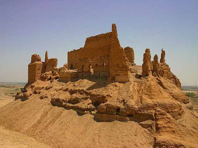
The desert does not constitute a distant margin from Deir ez-Zor, but rather a fundamental component of its history. Through it passed roads coming from Palmyra and central Syria, and from it branched paths leading to the Euphrates, Iraq, and the Khabur. Cities located on the river marked points where the pattern of movement changed: travelers or caravans would arrive from the desert to the valley, cross or follow the river, then continue their journey towards Iraq, Al-Jazira, or the Syrian interior. This relationship between the city and the desert explains the importance of sites like Al-Rahba, which the report describes as a fortress overlooking the valley and roads, monitoring the Euphrates route and ensuring communication between Iraq and the Levant.
1.8Deir ez-Zor: On the Path of Civilizations
The governorate's great historical value stems from its location within one of the oldest corridors of civilization in the Near East. Deir ez-Zor's profile indicates the presence of sites spanning from prehistoric eras to the Bronze, Assyrian, Babylonian, Hellenistic, Roman, Byzantine, and Islamic periods. Among the most prominent of these sites are Mari, Dura-Europos, Baghouz, Al-Rahba, Halabiye, Zalabiye, and Qarqisiya, in addition to sites along the Khabur River and recorded tells. This does not mean that the modern city of Deir ez-Zor was built directly upon one of these ancient cities. Rather, the importance of the governorate's center lies in its position within a network of major sites, serving as the modern gateway to them.
1.9From Prehistoric to Classical Eras
The sites scattered throughout the governorate and its surroundings reveal long phases of settlement and urban organization. Baghouz represents one of the early layers, while Mari offers a model of a royal city in the Bronze Age, and Terqa reveals another important center on the Euphrates. Then, Dura Europos emerges as a frontier city combining Hellenistic, Roman, and Eastern influences. The report presents Mari as a Bronze Age capital associated with palaces, writing, and kingdoms, in contrast to Dura Europos, which represents a Hellenistic and Roman frontier city linked to fortifications, multiple religions, the army, and arts.
1.10Islamic Eras
The importance of the Euphrates route continued into Islamic times, leading to the emergence of centers, fortresses, and cities connected to the movement along the route between Iraq and the Levant. Al-Rahba is a prime example of this, linked to Al-Mayadeen, the valley, and the river route, playing military and commercial roles at various stages. Euphrates cities also maintained their significance as points along a long axis connecting the Syrian interior with Iraq. However, the modern city we know today as Deir ez-Zor does not owe its fundamental urban form to these eras, which is an important point for understanding its identity; the major archaeological sites are older, while the current city more distinctly took shape in the late Ottoman period.
1.11The Rise of Modern Deir ez-Zor and the Ottoman Period
Despite the region's ancient settlement, the report clarifies that Deir Ezzor's growth into a distinct urban and administrative center was linked to the late Ottoman period, when control over the Euphrates route, communication with Iraq, and the organization of administration and trade became increasingly important. The establishment of an administrative center, a garrison, departments, markets, roads, bridges, and schools helped transform a limited riverine cluster into a city with a regional function. The Ottoman city comprised neighborhoods, markets, administrative and religious buildings, khans, coffeehouses, courtyard houses, warehouses, stables, and caravan routes, while its urban boundaries were much smaller than the city that would emerge in the 20th century. Most importantly, during this phase, Deir Ezzor began to shift from a site along the Euphrates route to a center managing the route itself.
1.12After the Ottoman Empire and the French Mandate
After the collapse of the Ottoman Empire, the region entered a new political phase that saw changes in administration, the drawing of borders with Iraq, customs organization, the establishment of official units and buildings, and the development of roads and communications. The modern borders introduced a new element to a region historically more interconnected along the Euphrates and the Badia desert. During the French Mandate, parts of the city expanded, and wider streets, administrative buildings, schools, barracks, health facilities, bridges, utility networks, and transport stations appeared, in addition to the planning of new neighborhoods. However, one of the most significant material and symbolic legacies of this period was the suspension bridge, which connected the two banks of the Euphrates and later transformed from an official engineering project into one of Deir ez-Zor's most famous symbols.
1.13Independence and Modern Urban Growth
Following independence, Deir ez-Zor's role expanded as the administrative, service, and cultural center of the governorate. The city continued to grow around new roads, institutions, and residential areas. This document traces the city's modern timeline, starting with the establishment of the Ottoman center and the expansion of the market, followed by the Mandate period and the construction of the bridge, then independence and the growth of institutions, leading to the founding of the Deir ez-Zor Museum and its evolving role in preserving the region's memory. The significance of this period lies in the emergence of a modern city with a distinct urban identity, differentiating it from the ancient archaeological sites in its vicinity.
1.14Oil and Modern Economic Transformation
Oil and gas increasingly entered Deir ez-Zor Governorate's economy during the second half of the 20th century, leading to the emergence of fields, work sites, and infrastructure related to transport, maintenance, services, and technical specialties. The report indicates that oil led to the construction of roads, expansion of transport, and the creation of job opportunities, technical professions, workshops, and services associated with the energy sector, alongside environmental impacts in some areas.
1.15The Historical and Cultural Identity of Deir ez-Zor
Deir ez-Zor differs from many governorates in that its modern center is not its oldest site. The current city clearly acquired its urban form during the Ottoman period and thereafter, while older cities, dating back thousands of years, are scattered around it. This gives the governorate an identity based on a network rather than a single city.
Mari Explores the Bronze Age.
Dura Europos elucidates the Hellenistic, Roman, and frontier worlds.
Al-Rahba illustrates the importance of the Euphrates route during the Islamic eras.
The Khabur adds another cultural corridor to the governorate's network.
The modern city of Deir ez-Zor illustrates how a site on the Euphrates transformed into an administrative, cultural, and service center.
The suspension bridge illustrates how a 20th-century structure can become an icon no less prominent in memory than ancient archaeological sites.
Deir Ezzor is situated at a location shaped by three major elements: the Euphrates River, the routes connecting Syria, Iraq, and the Jazira region, and the open desert (Badia) behind the valley. The interaction of these elements gave rise to a long-standing urban network extending from prehistoric sites to Mari, Dura Europos, and Al-Rahba, and then to the modern city of Deir Ezzor. The current city, in its basic form, does not date back to ancient times like Mari or Dura Europos. Instead, it took clearer shape during the late Ottoman era, when it became an administrative center along the Euphrates route. It then expanded during the Mandate and Independence periods with the establishment of roads, bridges, institutions, and new neighborhoods. In the twentieth century, Deir Ezzor became a more expansive urban center, its name associated with the Suspension Bridge, the museum, markets, and the Euphrates. The oil sector added a new layer to the economy and modern infrastructure without altering the fundamental truth: Deir Ezzor's identity is older and broader than oil, and broader than the current city itself. It is a governorate that must be understood through a long network of sites, roads, waters, and cities.
The Euphrates Connects the Place
The Desert Paves the Way.
The Khabur connects the valley to the al-Jazeera region.
Archaeological Sites Preserve the Depth of Time.
Modern Deir ez-Zor city connects this network and provides it with a contemporary center.
Cities in this governorate