Volume VIII · 7 chapters
Ar-Raqqa
A complete reference volume on Ar-Raqqa: geography, history and identity along the middle Euphrates; the city of Raqqa and the urban centres of Tabqa, Mansura, Maadan, Sabkha and Ain Issa; archaeology and heritage from Tuttul and Abbasid Rafiqa to Qalaat Jaabar; the Euphrates, the lake and the steppe; society, culture and local life; tourism and visitor experiences; and a practical cultural guide.
Chapter 01
Raqqa Governorate: Geography, History, and Identity
Raqqa Governorate stands out as one of Syria's most distinctive regions, particularly in the interplay between its geography and history. Situated in the heart of the Middle Euphrates Valley, it has for millennia served as a vital crossroads connecting the Levant, Mesopotamia, the Syrian Desert, and Anatolia. Raqqa's significance stemmed not from the location of a single city, but from an entire system shaped by the Euphrates River, fertile agricultural plains, the desert (Badia), caravan routes, crossings, and ancient sites that emerged along the river's course. Raqqa Governorate acts as a crucial link between the Levant and Mesopotamia, and between the fertile agricultural lands of the Euphrates Valley and the Syrian Desert stretching south and east, which has endowed it with continuous strategic, commercial, and military importance throughout history.
1.1Geographical Location of Raqqa Governorate
Raqqa Governorate is located in northern Syria, occupying a vast portion of the Middle Euphrates Valley. It is bordered by several governorates and regions that have made it a hub connecting the country's north, east, and center. It is linked to Aleppo in the west, Hasakah in the east, Deir ez-Zor to the southeast, and Homs and Hama to the south and southwest, while to the north, it connects to the area leading to Ain al-Arab (Kobane) and border regions. The significance of its location is evident in both historical and modern movement patterns. From the west, roads arrive from Aleppo; from the east, the Euphrates and its route continue towards Deir ez-Zor; from the north, plains extend towards the Jezirah region and the border; while to the south, the Badia (desert) opens onto vast stretches of the Syrian interior. Thus, Raqqa was never a geographical periphery, but rather a crossroads.
1.2Raqqa in the Middle Euphrates Valley
Raqqa cannot be understood without comprehending its position on the Euphrates. The river is not merely a natural feature passing through the governorate; it is the axis around which most ancient and modern settlements have arisen. The Euphrates is the primary water source, the foundation of agriculture, the core of human settlement, a historical transport route, and home to vast environmental diversity. Most major cities and villages were established on its banks or nearby. This explains why the region remained inhabited for long periods. Even as states, trade routes, and agricultural technologies changed, water, alluvial soil, and river transport remained elements attracting people to the valley.
1.3Area and Natural Regions
The governorate encompasses several distinct natural regions: the Euphrates Plain, the Northern Plateaus, the Southern Badia (desert), and the Euphrates Lake area. Each region is characterized by different economic and environmental activities. In the Euphrates Plain, irrigated agriculture and villages are concentrated. To the north, agricultural lands and plains extend, connecting to the Jezirah. In the south, steppes and the Badia dominate, supporting pastoralism and seasonal grazing. As for the western part of the governorate, the Euphrates Lake, formed in the 20th century, introduced a vast aquatic environment that significantly transformed the geographical and human landscape. Therefore, there isn't one singular 'natural Raqqa,' but rather several adjacent environments within the governorate itself.
1.4The Euphrates River and its Role in Shaping the Governorate
The Euphrates forged a long series of relationships between humans and the land. From its waters, agriculture emerged; from its banks came alluvial soil; and along its course, river ports, crossings, villages, and cities were established. In ancient times, it was a route for transporting goods and people, and in modern times, it became the basis for canals, pumping stations, and irrigation and power projects. Throughout history, the river has provided water, irrigation, fish, clay for construction, transportation, trade, and agricultural land. Therefore, the history of Raqqa can be read as much as a history of managing and benefiting from the Euphrates, as it is a history of kings and cities.
1.5Euphrates Lake and Euphrates Dam
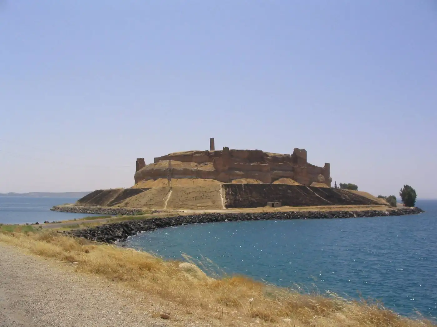
Euphrates Lake was formed after the construction of the Euphrates Dam, becoming Syria's largest artificial lake, which led to a significant transformation in the western part of the governorate. It provided a vast water reserve, fishing opportunities, tourism potential, and new habitats for birds and fish, also impacting agriculture and the local landscape. However, the lake was not merely a natural addition. Its creation altered the lives of entire villages, submerged lands and ancient sites, and led to the emergence of land reclamation projects, irrigation networks, and communities linked to the dam and its power generation. Therefore, the history of the lake is simultaneously an engineering, social, and environmental history.
1.6The Northern Plains and Plateaus
North of the Euphrates, vast plains extend, gradually connecting with the Syrian Jazira, comprising agricultural lands, villages, and pastures. Some areas rely on irrigation, while rain-fed agriculture is directly impacted by the amount and distribution of rainfall. These regions represent a natural transition towards the plains of the Syrian Jazira. The plateaus, on the other hand, are relatively higher than the floodplains and are used for cultivating cereals, grazing, and establishing roads and villages, though they are more susceptible to drought, winds, and erosion. These topographical features form an important backdrop for understanding areas such as Ain Issa, Tell Abyad, and the northern countryside.
1.7The Southern Badia
South of the Euphrates lies the Syrian Badia (steppe/desert), which is not a continuous sand desert but an area encompassing dry steppes, stony lands, seasonal wadis, and pastures that largely depend on rainfall. The Badia is characterized by scarce rainfall, hot summers, scattered water sources, the prevalence of drought-resistant plants, and a historical reliance on grazing and mobility. This environment was an important part of Raqqa's social history, as it was associated with tribes, herders, ancient trade routes, and caravans. In rainy years, pastures improve, while drought leads to significant changes in herder movements, fodder costs, and livelihoods.
1.8Climate, Water, and Soil
Raqqa experiences a dry to semi-arid continental climate, characterized by long, intensely hot summers and winters that are colder than visitors might expect from a semi-desert region. Conditions also vary between areas close to the river and lake versus the plains and the Badia. Agricultural activity relies on the Euphrates, irrigation canals, and groundwater in some areas, while the soil types vary from fertile alluvial near the river to clayey, calcareous, gypsiferous, and desert soils. However, water abundance does not mean an absence of problems. Salinity, poor drainage, drought, dust storms, and deteriorating irrigation networks are all factors that affect land productivity.
1.9Population and Settlement Patterns
Historically, the population was distributed among cities, towns, Euphrates villages, farms, and the Badia, with water being the most influential factor in settlement density. The closer people settled to the river, canals, and arable lands, the greater their opportunities for permanent settlement, while some Badia regions remained linked to seasonal movements and grazing. The community in the province is rich in tribes and families settled along the banks of the Euphrates and in the agricultural plains, alongside urban and town dwellers, which has created a culture that blends urban, rural, and Bedouin heritage.
1.10Tribes and Euphrates Society
Tribes played a significant role in the province's history, contributing to population stability, agriculture, the protection of trade routes, rural development, and the preservation of social traditions. However, studying tribes should not devolve into undocumented genealogies or rigid classifications. Society has changed with settlement, agriculture, cities, education, migration, and wars, and the relationships between family, village, tribe, state, and market have evolved over time.
1.11Beginnings of Settlement and Prehistory
The roots of settlement in the Raqqa region extend to distant eras preceding written history. Water, soil, hunting, wild plants, and ease of movement contributed to the emergence of early agricultural societies along the banks of the Euphrates. This period holds particular importance because it predates cities, states, and writing. During this time, humans gradually transitioned from a primary reliance on hunting and gathering to settlement, agriculture, animal domestication, and the construction of permanent dwellings. Beneath the hills of Raqqa and the Balikh Valley lie archaeological layers that reflect these transformations.
1.12The Agricultural Revolution and the First Cities of the Euphrates
The Euphrates valley witnessed one of the most significant stages of agricultural transformation, as communities began cultivating wheat, barley, lentils, and pulses, alongside the domestication of sheep, goats, and cattle. Agricultural stability led to the construction of more organized villages, and subsequently, to the emergence of larger settlements. With an increase in population, the need for storage, administration, and exchange arose, and villages evolved into cities surrounded by walls, markets, and temples. This marked the true urban history of Raqqa, millennia before the Abbasid era.
1.13Tutul and Bronze Age Civilizations
Tel Bi'a, which conceals the ancient city of Tutul, represents one of the most important archaeological sites in the governorate. The ancient city, located near modern-day Raqqa, flourished from the third millennium BC, boasting a river port, temples, palaces, walls, and a network of trade routes. Its strategic location at a crucial crossing point on the Euphrates allowed it to control trade, agriculture, and caravan movements, and it also became a religious center linked to the worship of the deity Dagan. Tutul was connected to Mari, Ebla, and other cities in the region, confirming that ancient Raqqa was not isolated but part of a vast economic and diplomatic network.
1.14The Akkadians, Amorites, Assyrians, and Arameans
During the Bronze and Iron Ages, the region came under the influence of various powers from Mesopotamia and northern Syria. Akkadian influence reached the cities of the Euphrates, then the Amorites played a significant political role in Mari and Tutul, and later, the region fell within the Assyrian sphere at different times. Additionally, Aramean groups settled across large areas of northern Syria, and Aramaic later became one of the primary languages in the region. These stages illustrate that Raqqa was always a crossroads and a zone of mutual influence between the civilizations of the Levant and Mesopotamia.
1.15The Persian and Hellenistic Eras
The Raqqa region became part of the Achaemenid domain after the expansion of the Persian Empire, then transitioned into a new phase following the campaigns of Alexander the Great and the establishment of the Seleucid state. This period saw the replanning of some cities and the spread of Greek culture, alongside the continued agricultural and commercial activities of the local population. During this time, a city known as Nikephorion was founded near the current site of Raqqa, becoming an administrative center on the Euphrates. This underscores the enduring importance of the site itself, even as the city's name and political authority changed.
1.16Raqqa in the Roman and Byzantine Eras
The region later became part of the Roman world, gaining additional importance due to its proximity to the empire's eastern borders. The Romans focused on fortifying borders, organizing trade, and improving roads, while the Euphrates became a front line between the Roman (and later Byzantine) Empire and the Parthian and Sasanian powers. During the Byzantine era, agriculture and trade continued, and churches, religious centers, and fortifications emerged. Resafa is considered one of the most important sites representing this later period.
1.17The Islamic Conquest and the Umayyad Era
Raqqa became part of the Islamic state during the 7th century AD, leading to changes in administration, economy, urban development, roads, religious life, and trade. During the Umayyad era, the city's importance grew due to its proximity to the northern frontiers and its location on the route between Damascus, Iraq, and Anatolia. It became a center for supplies, military movements, and trade. Resafa, during the Umayyad era, also became one of the most important centers linked to the desert and trade routes.
1.18The Abbasid Era and the Flourishing of Raqqa and Al-Rafiqa
The Abbasid period represents the most significant urban and political phase in the history of the city of Raqqa. Around 155 AH/772 CE, Caliph Abu Ja'far al-Mansur ordered the construction of a new city adjacent to Raqqa, known as Al-Rafiqa. Its location was chosen for its proximity to the Euphrates River, trade routes, borders, and its defensive and expansion potential. Al-Rafiqa was built with walls, towers, gates, streets, mosques, palaces, and markets. The region then reached its peak of prosperity during the reign of Harun al-Rashid, who resided there for long periods and managed a significant part of state affairs from it. Raqqa and Al-Rafiqa became a center for governance, trade, industry, science, and arts. Its industries became famous, including ceramics, which are among the most renowned products of Islamic art associated with the city's name.
1.19Later Stages and the Modern Era
Raqqa's significant political role began to decline with the shift of decision-making centers and changes in trade routes and military powers. However, the city and region remained part of the settlement network along the Euphrates. Agriculture, pastoralism, trade, fishing, and crafts continued as essential elements of local life. In the modern era, the construction of the Euphrates Dam, Lake Assad (Euphrates Lake), and irrigation and reclamation projects led to a profound transformation in the western part of the governorate. The city of Al-Thawra (Tabqa) emerged as a center linked to the project, energy, agriculture, and services. Population movements also changed, new villages appeared, and communities relocated from areas submerged by water. The material describes the modern city of Al-Thawra as directly linked to the dam and the lake, and to work in water, energy, and agriculture projects. The recent decades have left deep impacts on the population, sites, urban structure, services, and memory.
1.20The Cultural Identity of Raqqa Governorate
Raqqa's identity is based on a set of interconnected elements. The Euphrates is the source of water, stability, agriculture, and trade. The plain is the domain of wheat, cotton, villages, and agricultural projects. The desert (Badia) represents pastoralism, movement, tribes, and desert routes. The city carries layers of Tutul, Nicephorium, Raqqa, and Al-Rafiqa. Lake Assad (Euphrates Lake) represents modern engineering transformation and the memory of submerged villages. Society combines urban, rural, Bedouin, and tribal life in one space. Therefore, Raqqa is distinct as both a riverine and desert city, home to prehistoric centers, a nexus between the Euphrates and Balikh rivers, a major Abbasid city, close to Resafa, linked to a vast artificial lake, and combines agriculture, pastoralism, fishing, and social and linguistic diversity.
Raqqa governorate reveals a history inseparable from its geography. Since the emergence of the first agricultural societies on the banks of the Euphrates, water has been the element enabling stability, production, transport, and trade. Then cities like Tutul emerged, and the region became part of extensive civilizational networks connecting the Levant with Mesopotamia. The region witnessed a succession of powers and civilizations, from the Akkadians, Amorites, Assyrians, and Arameans to the Persians, Hellenists, Romans, and Byzantines, before entering the Islamic phase, during which Raqqa would reach the peak of its urban and political history. In the Abbasid era, Al-Rafiqa appeared with its walls, gates, mosque, and palaces, and Raqqa, during Harun al-Rashid's reign, transformed into a political, military, cultural, and economic center of paramount importance. The remains of the wall, mosque, palaces, and Abbasid structures are still among the most important evidence of that period. However, the governorate's identity is not solely based on urban history. The northern plains, the southern Badia (desert), Lake Assad, agricultural villages, tribes, pastures, and river fishing are all part of the same picture. This is what makes Raqqa unique: a land that combines water and desert, city and village, agriculture and pastoralism, ancient civilizations and the Abbasid capital, and the modern water project within a single region.
Cities in this governorate